Showing all 9 results
-
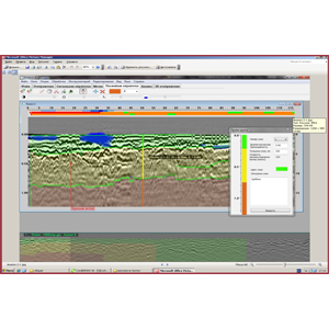
Analysis, the new software package for automated processing of GPR profiles and building of 3D profiles of features. Especially important application of this program during the examination of extended sites: roads, railways, as well as water area sites and others.
$1,000.00 Add to Quote -
GeoTechControl software is designed to process and interpret data obtained by the seismo-acoustic method of surveying building structures.
$1,000.00 Add to Quote -

Impact Method is software for automated determination of the thickness and defects of foundation slabs, as well as the state of contact of the slab with the subgrade.
Add to proposal -
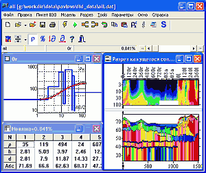
IPI2Win software is designed for one-dimensional interpretation of VES data for one observation profile. The user of IPI2WIN is a geophysicist who aims to find both a satisfactory fit of curves and a solution of a geological problem. What distinguishes IPI2Win from common programs for the automatic solution of the inverse problem is its focus on the geological result.
Add to proposal -
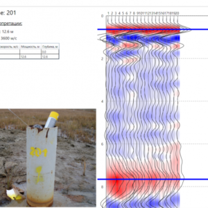
Pilemeter 1.0 automatically determines the length of the pile, or the speed of the acoustic wave in the pile. The software is designed to make work with the data obtained using the IDS-1 pile testing device simple and intuitive for the user.
Add to proposal -

Specialised software for presenting measurement data of geophysical parameters obtained using the IDS-2 pile testing device.
Add to proposal -

The RadExPro Plus software package is designed for complex processing and quality control of seismic data, processing of VSP and GPR data.
Add to proposal -
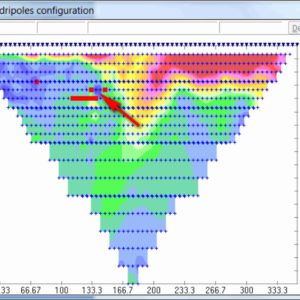
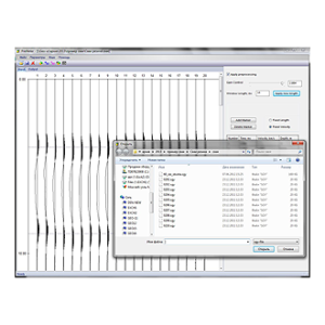
X2IPI is designed to work with multielectrode sounding data (Electrotomography, Electrical resistivity tomography, Resistivity imaging). The software allows users to set up the equipment to the optimal method of work, check and evaluate the quality of field data, process the data of the method of resistance and induced polarisation, and convert them into the formats of common 2D inversion programs.
Add to proposal -
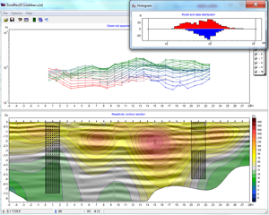
ZondRes2d software is designed for two-dimensional interpretation of electrical tomography data by the method of resistivity and induced polarisation of earth, borehole and offshore formations.
Add to proposal
Showing all 9 results